Draw area · weekly
Swap the Monday phone round for a map of your draw area.
Crop Progress gives you one number for the whole state. Harvest Progress maps percent harvested across the fields that feed your elevator, every week of the harvest window, so intake, drying and bids get planned before the grain reaches the scale house.
- GSD
- Wide / 10-30 m
- Cadence
- Weekly
- Platform
- Wide-swath satellite
- Spectral
- Multispectral
Monday, 4 p.m.
USDA's Crop Progress report lands with one percent-harvested number per state. Your intake depends on a much smaller patch. So the week gets planned off the phone: a few growers, the drivers, whoever answers at the elevator two towns over. By the time that adds up, wet corn is lined up at the scale house and the dryer is a day behind. Guess the other way and you've called in extra help for a dump pit that sits quiet on Tuesday.
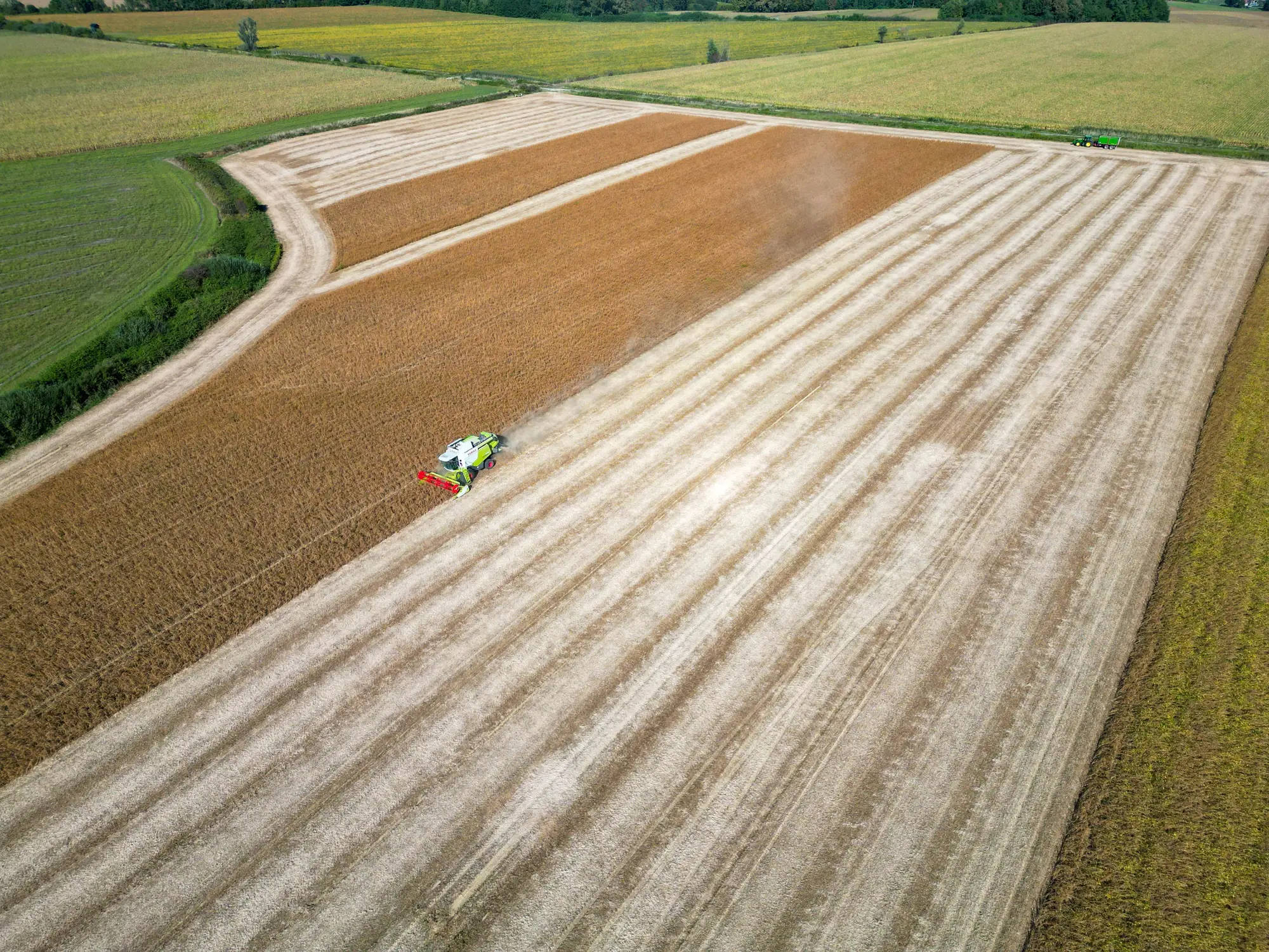
The same week, planned two ways
The intake meeting
The phone roundThe state number from Crop Progress, plus whatever growers and drivers said since Friday.
With Harvest ProgressThis week's map of your draw area, shaded cell by cell from standing to cut, with the cells cut since the last pass picked out.
Scale house hours and crew
The phone roundSet off a hunch about which side of the draw area opens up next.
With Harvest ProgressIf the front has crossed the east half, the next trucks come from the west. You staff the scale house and the pit for that.
Drying and wet storage
The phone roundYou find out the dryer is behind when wet corn is already waiting at the pit.
With Harvest ProgressLast week's pace through wet corn ground shows up a week ahead, which is time to free wet bin space, run the dryer around the clock or slow receiving.
Still yoursReading moisture off the probe and deciding how many points the dryer can pull.
Setting bids
The phone roundThe merchandiser weighs the state number against the calls coming in from growers.
With Harvest ProgressHarvest pace for the elevator's own territory, set next to the state number, when bids get changed and grower calls get taken.
Booking outbound freight
The phone roundSpace gets tight, then trucks, rail cars or barge freight get booked.
With Harvest ProgressSet the zone CSV next to Monday's state number. When your area runs ahead of the state, you see it in time to book sooner.
Checking what's actually coming in
The phone roundScale tickets, and what drivers tell you at the window.
With Harvest ProgressThe same scale tickets and drivers. The map tells you which part of the draw area to ask about.
Still yoursThe scale tickets. The map counts ground cut and never replaces them.
What lands each week
One set of files per week through the harvest window, in formats your GIS or spreadsheet already opens.
- GeoJSON
Percent-harvested map
Your draw area on a grid, each cell shaded from standing crop to cut. It's the page you bring to the intake meeting, and it opens in whatever GIS you or your co-op already run.
- GeoJSON
Where the front moved
The cells that went from standing to cut since last week's pass, flagged on their own. You see which way harvest is working across the area, and how fast.
- CSV
Percent harvested by zone
Send the zones you plan by: counties, townships or rings around the elevator. Each one gets its percent harvested this week and last, ready for the spreadsheet the merchandiser and the freight desk already keep.
- Pass note
A note on each pass
The dates the imagery came from and which parts of the area sat under cloud, so you know how fresh each corner of the map is.
Through the harvest window
You send the area once. The map comes back every week until the last loads are in.
Before the first loads
- 01
Send your draw area
A boundary file, a list of counties or a radius around the elevator. Add the zones you want the CSV broken out by.
- 02
Set the harvest window
Tell us when you expect the first loads locally and roughly when you'll be done. That sets the weeks we run.
- 01
Every week of harvest
- 03
Weekly pass, compared
Wide-swath multispectral imagery over the whole area, checked against the prior week. Ground that went from standing to cut gets flagged.
- 04
Map goes out
That week's GeoJSON, CSV and pass note, in time to plan the next stretch of intake.
- 03
After the last loads
- 05
The run stops
The weekly run ends with the window you set. If harvest drags into November, tell us and we'll talk about moving it.
- 05
What the phone round still does better
Read these before you plan a week around the map.
- Cloud can push a week back
- The imagery is optical. If cloud sits over part of your area on every pass that week, that part stays on last week's reading and the pass note says so. An update can run a few days late behind weather. A grower on the phone doesn't have that problem.
- One farm, one field
- At 10-30 m the map reads a whole draw area well. It won't draw field edges, and it can't tell you whether one particular farm is finished. The grower can.
- Area cut, not bushels
- The map counts ground harvested. It doesn't estimate yield, tonnage or moisture, or say when a load will reach the pit. Your scale tickets and the drivers still do that.
- Cut ground, any crop
- Corn and soybean fields both show as cut once they're harvested. The layer doesn't split them out, so read it alongside what you know is planted where.
- Weekly is the target
- We plan to a weekly cadence through the window you set. A phone call is today's news. The map isn't a daily feed, and we don't promise a delivery hour.
Who it's for
Switch if
- You run intake, drying or storage at a country elevator or terminal and plan the week around a draw area.
- You set bids and want harvest pace for your own territory next to the Monday Crop Progress number.
Stick with the phone round if
- You're a grower after advice on one field. At 10-30 m this is a view of the whole area.
- You need a yield or bushel estimate.
- You need to know where the combines or trucks are right now. The map updates once a week.
Before you switch
Do we stop calling growers?
No. The calls get shorter. The map shows which part of the draw area is moving, so you know whose number to dial.
How do we check it against what we're seeing?
For the first few weeks, hold it up against your own scale tickets and what drivers and growers tell you. If part of the area looks wrong, send it back and we'll go through that week's imagery with you.
Can cloud cover delay a week's update?
Yes. Optical imagery needs a clear view of the ground. When cloud hangs over part of the area, that update can run a few days late, and the pass note marks which parts are still on older imagery.
What resolution is this?
10-30 m per pixel. Enough to follow the harvest front across a draw area. Don't expect it to pick out field edges or single fields.
How often does it update, and for how long?
Weekly, for the harvest window we agree at the start. If harvest opens early or drags into November, tell us and we'll talk about moving the window.
Will it plug into our grain accounting or scheduling software?
There's no direct integration. You get GeoJSON for a GIS and a CSV that opens in a spreadsheet or loads into anything that takes CSV.
Can we run it for more than one location?
Yes. Send a draw area for each elevator. Areas that overlap between your own locations are fine.
Who owns the maps, and can we share them?
Your boundary and zones stay yours. What you can do with the map files, and the licence on the satellite imagery behind them, gets written into the project agreement before the first week runs.
How is it priced?
It depends on the size of the draw area and how many weeks you want covered, so we quote after we've seen the area. There's no price list on this page.
Tell us your draw area before the combines roll.
Send a boundary, or just the counties and where the elevator sits, plus when you expect the first loads. We'll scope the weekly run from there.